
Searching for mh370
Searching for MH370
In July 2015, a plane debris which was later confirmed as originating from the missing Malaysian Airline MH370 aircraft reached the shoreline of the Island of La Réunion.
We proposed a particle dispersal model to track where the MH370 plane debris found in Réunion Island could have originated from. The numerical model is forced by environmental data using publically available real time global HYCOM sea surface current and NCEP/NCAR sea surface wind reanalysis products. A key parameter for the model was the rate at which the debris is pushed by the oceanic winds. This is called the ‘windage’ coefficient and is function of debris shape and floatability. We used a rate of 1.5% similarly to the coefficient used for CSIRO’s modelling assessment.
However, the main difference here is instead of looking at where debris from the MH370 search area would have ended up, we are looking at where debris that landed in Reunion Island in July 2015, could have come from. In that sense we backtracked the trajectories of particles from present to March 8th, 2014 when MH370 disappeared. The modelling results show the source distribution of particles reaching the remote island in the Indian Ocean. The MH370 search zone derived from the last known satellite communication, crosses the highest density area for particle origins.
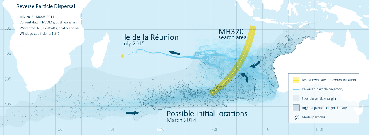
Reverse particle tracking from La Réunion back to the Indian Ocean